North American Datum of 1983 (NAD83) World Geodetic System of 1984 (WGS84). Projection and 1 000-meter grid: Universal Transverse Mercator, Zone 13S 10 000-foot ticks: New Mexico Coordinate System of 1983 (central zone)
UTM GRID AND 2013 MAGNETIC NORTH DECLINATION AT CENTER OF SHEET
100,000-m Square ID
CU Grid Zone Designation
13S
9000 880 0
8200
8000
8800 880 0
90 00
' Cañon de Baca
Gallo Peak
Cañon de Baca
9400
9600
860 0
9200 9600
1
1000
500
0
69
68
3
0.5
1000
0.5 2000
Cañon Sal Si Puedes
7300 7200
Cañon Sal Si Puedes
33000mN
38
7400
7200
8400
67
1
7800
8800
9000
3
27' 30"
McKinley Place
820 0
Cañon del Chato
9600
34
38
7600
Cañon Colorado
9400
1000
U.S. National Grid
Manzano
9200
× MN
Spruce Spring
3
9400 000 SCALE 1:24
Colorado Spring
'
0
KILOMETERS
1
2
0
METERS 0
1000
2000
3000
4000
MILES FEET
5000
6000
7000
CONTOUR INTERVAL 40 FEET NORTH AMERICAN VERTICAL DATUM OF 1988 This map was produced to conform with the National Geospatial Program US Topo Product Standard, 2011. A metadata file associated with this product is draft version 0.6.15
8000
70
3
9000
25'
3
Red Canyon Trailhead
E
Produced by the United States Geological Survey
9800
8800 3
▬
8600
8200
V A L E N C IA C O TORRANCE CO
7000
7600
1 570 000 FEET
'
10000
106°30'
63
3
8200
8400 8000
6200
FEET
400
Cañon de los Pino Reales
9200
Bear Spring
8600
00 76
720 0
00 78
Cañon de Bartolo
94 00
E
1320000
Cañon del Trigo
Cañon de Salas 9000
35
38
7400
8000
7600
33
Bartolo Spring 8000
9600
8000
38
E
63 00
8600
840 0
3 5 8
'
980 0
7600
7400
E
6800
Sherman Spring
9600
Bartolo Trick Tank
'
8200
0 840
7800
0 780
8600
34
38
7400
36
9200
6600
72 00
40'
7300
E
74 00
8800
37
Cañon de Bartolo
00 90
9000
8400
38
9200
Beehive Spring
Ojo Salas
o
38
9200
YCC Spring
7000
CIBOLA NATION AL FOREST
00 88
00 68
Trigo Spring
00 78
Salas Forest Service Facility
66 00
zan
84 00
8200
Pothole Spring
6400
730 0
an de M o y Arro
T ES R FO AL N IO AT N
Cañon de la Capilla
CI
BO
LA
60 00
Log Spring
38
38
800 0
00 76
7000
7600
35
38
6600
00 76
6600
00 64
7200
Cañon de Salas
6400
8000
00 78
8000
New Canyon Spring
8200
86 00
00 82
00 84
0 800
7800
6800
34° 37' 30"
'
7400
E
7600 00 78 72 00
7400
36
CIBOLA NATION AL FOREST 6
New Canyon Trailhead
o
86 00
780 0
6800
7000
38
Berrendo Spring
an
Turrieta Spring
New Canyon Number Two Spring
yo
37
38
nz
8600
Osha Peak
0 740
40'
E de Ma
ro
8800
0 640
'
New Canyon Number One ' Spring
Ar 0 840
70 00
6600
5800
John F Kennedy Campground
8800
9200
Cañon del Trigo
32
8600 Cañon Nuevo 84 0 Arroyo 0 de Manzano Cañon de Turieta
00 82
7200
38
0 860
00 84
Sand Spring
8000
Cañon del Encierro
E
6000
8200
7800
5800
7600
38
00 74
5800
Commanche Trailhead
Upper Jaramillo Spring
Whisky Spring
71
72
34° 37' 30"
73000mE
3
106° 22' 30"
3
ROAD CLASSIFICATION
1 10000
Expressway
Local Connector
Ramp
4WD
Local Road
Secondary Hwy
NEW MEXICO
QUADRANGLE LOCATION
Los Lunas SE
Bosque Peak
Tajique
Tome NE
Capilla Peak
Torreon
Tome SE
Manzano Peak
Punta de Agua
ADJOINING 7.5' QUADRANGLES
X W Interstate Route
. US Route /
J FS Primary Route
K
FS Passenger Route
H State Route
Check with local Forest Service unit for current travel conditions and restrictions.
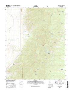
CAPILLA PEAK, NM 2013
FS High
L Clearance Route
7 6 4 3 0 1 6 3 8 2 7 7 0 NSN. NGA REF NO. U S G S X 2 4 K 7 1 9 3
Eureka. Mesa. San Pedro. Peaks. San Pedro. Peaks. San Pedro. Mountains. Puertecito de las Perchas ... 8 Seven Springs. 2 Gallina. 3 Arroyo Del Agua. 4 Cuba.
Río San. R ío de las Vacas. Río Guaonica. Río Viví. R ío. Grande de Arecibo. Río ... Jordan. Lago. Adjuntas. PO. Adjuntas. Quebrada. La Mocha. Quebrada.
Haystac. Mounta. D o g. M o u n ta in s. Dog. Spring. Ranch. D eer. Flat. Eagle. Mountain. Campbell. Well. Sentinel. Butte. Dog. Mountains. Pierce. Peak. Corner.
Rio Grande. Rio Grande. Rio Grande. R io. G ra n d e. Rio Grande. R io. G rande ... Canyon. Quinn. Creek. Gettysburg. Peak. McCutchen. Ranch. Candelaria. 13.
S 220TH ST. RENTON AVE S. W JAMES ST. S 127T ..... E JAMES ST. SW 34TH ST. SW 7TH ST. 8. 4. T. H ..... 1 Seattle South. 8 Black Diamond. 2 Mercer Island.
84TH ST SE. 86TH ST SE. 84TH ST SE. 8. 9. T. 83RD ST SE. 8. 6. T. H. A. V. E. S. E. 88TH ST SE. 86TH ST SE. 88TH ST SE. C. R. -3. M a p le. R iv er. Maple River. S. F o rk. M a p le. R iv e r. Maple River. Monango. Boynton. 30'. 98°. 46°. 30". 46°. 3
River. Rush River. Lower Br Rush River. Rush River. M aple River. Maple River. R u sh. R iver. Mapleton. Cem. Newman. Mapleton. Prosper. 30". 00'. 97°. 30".
Bull Tank. North Tank. Green. Tank. Continental Tank. Mangas Cr. L a r g o. C r. Caballeriza. Tank. Hell Hole. Tank. Largo. Canyon Tank. El Caso. Lake. Gooseberry. Pit. Indio. Canyon Tank. Jacobs. Camp Tank. San Antone. Tank. Slaughter. Mesa Tank. Ca
Arkansas River. A rkansas River. A rk a n sas River. A rk a n sa s. R iv e r. Ellinwood. PO. Grove Park Golf. Course. Saint. Josephs Cem. Big Salt. Marsh. Alden.
Laguna. Polvadera ra nk. San Isidro. Spring. San Lucas. Spring. San Miguel Spring. Sap Hole. Spring. Fort Miguel Ruins ... Las Yeguas. Canyon. El Dado Peak.