USGS 7.5-minute image map for May Lake NW ... - The National Map
5. 0. 2. 1. 0. 0. 2. 0. 5. 0. 2050. 2150. 2150. 2200. 2150. 2200. 83RD ST SE. 87TH ST SE. 82ND ST SE. 3. 3. R. D. A. V. E. S. E. 3. 3. R. D. A. V. E. S. E. 3. 6. T. H.
Produced by the United States Geological Survey North American Datum of 1983 (NAD83) World Geodetic System of 1984 (WGS84). Projection and 1 000-meter grid: Universal Transverse Mercator, Zone 14T 10 000-foot ticks: North Dakota Coordinate System of 1983 (south zone)
UTM GRID AND 2014 MAGNETIC NORTH DECLINATION AT CENTER OF SHEET U.S. National Grid 100,000-m Square ID
MS Grid Zone Designation
14T
4
48
40'
SCALE 1:24 000
^ MN
4
47
46
42'30"
0.5
0
KILOMETERS
1
2
1000
500
0
METERS 0
1000
2000
0
1000
2000
3000
4000
MILES FEET
5000
46°07'30"
4
4
51000mE
50
49
99°37'30"
ROAD CLASSIFICATION
1
0.5
2150
31ST AVE
10
SE
22 00
51
6000
7000
CONTOUR INTERVAL 10 FEET NORTH AMERICAN VERTICAL DATUM OF 1988 This map was produced to conform with the National Geospatial Program US Topo Product Standard, 2011. A metadata file associated with this product is draft version 0.6.16
8000
9000
NORTH DAKOTA
1 10000
QUADRANGLE LOCATION
1
2
4 6
3 5
7
8
ADJOINING QUADRANGLES
1 2 3 4 5 6 7 8
Schell Buttes Wishek SW Wishek Weisser Dam East May Lake Hague SE May Lake SW May Lake SE
Expressway
Local Connector
Ramp
4WD
Local Road
Secondary Hwy
X W Interstate Route
. US Route /
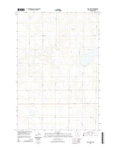
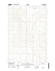
MAY LAKE NW, ND 2014
H State Route
7 6 4 3 0 1 6 3 8 0 2 0 9 NSN. NGA REF NO. U S G S X 2 4 K 2 8 1 0 7
20 ago. 2015 - This map was produced to conform with the. National Geospatial Program US Topo Product Standard, 2011. A metadata file associated with ...
3 Coldwater Lake. 4 Schumacher Lake NE. 5 Long Lake NE. 6 Schumacher Lake. 7 Long Lake. ADJOINING QUADRANGLES. 1. 2. 3. 4. 5. 6. 7. 8. This map was produced to conform with the. National Geospatial Program US Topo Product Standard, 2011. A metadata f
2150. 2000. 2150. Wishek Municipal. Airport. ¬«3. ¬«3. ¬«3. ¬«3. 4. 2. N. D. A .... 5 Danzig. 6 May Lake SW. 7 May Lake SE. ADJOINING QUADRANGLES. 1. 2.
Eureka. Mesa. San Pedro. Peaks. San Pedro. Peaks. San Pedro. Mountains. Puertecito de las Perchas ... 8 Seven Springs. 2 Gallina. 3 Arroyo Del Agua. 4 Cuba.
Río San. R ío de las Vacas. Río Guaonica. Río Viví. R ío. Grande de Arecibo. Río ... Jordan. Lago. Adjuntas. PO. Adjuntas. Quebrada. La Mocha. Quebrada.
Haystac. Mounta. D o g. M o u n ta in s. Dog. Spring. Ranch. D eer. Flat. Eagle. Mountain. Campbell. Well. Sentinel. Butte. Dog. Mountains. Pierce. Peak. Corner.
Rio Grande. Rio Grande. Rio Grande. R io. G ra n d e. Rio Grande. R io. G rande ... Canyon. Quinn. Creek. Gettysburg. Peak. McCutchen. Ranch. Candelaria. 13.
S 220TH ST. RENTON AVE S. W JAMES ST. S 127T ..... E JAMES ST. SW 34TH ST. SW 7TH ST. 8. 4. T. H ..... 1 Seattle South. 8 Black Diamond. 2 Mercer Island.
84TH ST SE. 86TH ST SE. 84TH ST SE. 8. 9. T. 83RD ST SE. 8. 6. T. H. A. V. E. S. E. 88TH ST SE. 86TH ST SE. 88TH ST SE. C. R. -3. M a p le. R iv er. Maple River. S. F o rk. M a p le. R iv e r. Maple River. Monango. Boynton. 30'. 98°. 46°. 30". 46°. 3
River. Rush River. Lower Br Rush River. Rush River. M aple River. Maple River. R u sh. R iver. Mapleton. Cem. Newman. Mapleton. Prosper. 30". 00'. 97°. 30".