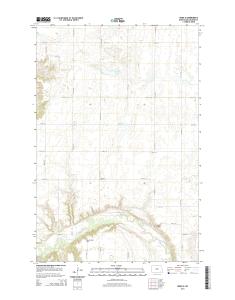
USGS 7.5-minute image map for Dwight, North Dakota
This map was produced to conform with the. National Geospatial Program US Topo Product Standard, 2011. A metadata file associated with this product is draft ...
Produced by the United States Geological Survey North American Datum of 1983 (NAD83) World Geodetic System of 1984 (WGS84). Projection and 1 000-meter grid: Universal Transverse Mercator, Zone 14T 10 000-foot ticks: North Dakota Coordinate System of 1983 (south zone), Minnesota Coordinate System of 1983 (central zone)
UTM GRID AND 2014 MAGNETIC NORTH DECLINATION AT CENTER OF SHEET U.S. National Grid 100,000-m Square ID
PS Grid Zone Designation
14T
179TH AVE SE
178TH AVE SE
6
42'30"
1
0.5
1000
500
0
1000
ld
0.5 2000
ce Ri
Riv
6
6
6
78
79
er
40'
SCALE 1:24 000 KILOMETERS
1
2
0
METERS 0
1000
2000
4000
MILES FEET
5000
81
2 020 000 FEET (MN C)
25000mN80TH ST SE
46°15' 96°37'30"
6
82000mE
ROAD CLASSIFICATION
0
3000
6
80
51
6000
7000
CONTOUR INTERVAL 5 FEET NORTH AMERICAN VERTICAL DATUM OF 1988 This map was produced to conform with the National Geospatial Program US Topo Product Standard, 2011. A metadata file associated with this product is draft version 0.6.16
8000
9000
NORTH DAKOTA
1 10000
QUADRANGLE LOCATION
1
2
4 6
3 5
7
8
ADJOINING QUADRANGLES
1 2 3 4 5 6 7 8
Galchutt Abercrombie Wahpeton NE Mooreton East Wahpeton Great Bend Fairmount NW South of Wahpeton
Expressway
Local Connector
Ramp
4WD
Secondary Hwy
Local Road
X W Interstate Route
. US Route /
DWIGHT, ND-MN 2014
H State Route
7 6 4 3 0 1 6 3 7 9 7 4 6 NSN. NGA REF NO. U S G S X 2 4 K 1 3 1 9 4
9 abr. 2014 - 46°. 30". 10'. 30". 40'. FEET. 30". 07'30". 000. 4. FEET. 2. 51. 4. 66. 73. 30". 51 ... State Route. US Route. W. X . /. H. This map was produced to conform with the. National Geospatial Program US Topo Product Standard, 2011.
Millers. Cem. Unorganized. Territory of Dixon. Streeter Flats .... 10 000-foot ticks: North Dakota Coordinate System of 1983. (south zone). This map is not a legal ...
9 abr. 2014 - H. This map was produced to conform with the. National Geospatial Program US Topo Product Standard, 2011. A metadata file associated with ...
2 abr. 2014 - V. E. S. E. 2ND AVE. C. R. -3. 7. 0. 5. 1. 1. 8. T. H. A. V. E. S. E. 64T. 1. 1. 7. T. H. A .... 10 000-foot ticks: North Dakota Coordinate System of 1983.
This map was produced to conform with the. National Geospatial Program US Topo Product Standard, 2011. A metadata file associated with this product is draft ...
9 abr. 2014 - C. O. KIDDER CO. KIDDER CO. Long Lake. Pursian. Lake. Bethel Cem. 30". 45' .... 10 000-foot ticks: North Dakota Coordinate System of 1983.
25 mar. 2014 - I. C. K. E. Y. C. O. S. A. R. G. E. N. T. C. O. J a m e s. R iv e r. Ludden. Ludden. 07'. 98°. 98°. 46°. 46°. 07'. 00'. 46°. NR. 30". 30". 30". 30". 2'. 98°.
C. H. E. N. R. Y. C. O. W. A. R. D. C. O. Gen urrey. Surrey. 53. 000m. 48°07'. 53. 49. 41. 50. 53. 3. 47. 5'. 53. 101°. 10'. 48. 3. 3. E. 43. 101°. 30". 53. 840. 00'. 000.
C r. S a n d. C r. H aw k. C r. Saint. Paul Cem. Hazelton. 22'. 20'. 15'. 30". 30". 22'. 46°. 46°. 100° .... 10 000-foot ticks: North Dakota Coordinate System of 1983.
15 abr. 2014 - ver C reek. S Branch Beaver Creek. Saint. Marys Cem. Hague. 30". FEET. 30". 4 .... 10 000-foot ticks: North Dakota Coordinate System of 1983.
10 000-foot ticks: North Dakota Coordinate System of 1983. (south zone). This map is not a legal document. Boundaries may be generalized for this map scale.
C r. S a n d. C r. H aw k. C r. Saint. Paul Cem. Hazelton. 22'. 20'. 15'. 30". 30". 22'. 46°. 46°. 100° .... 10 000-foot ticks: North Dakota Coordinate System of 1983.
C. H. E. N. R. Y. C. O. W. A. R. D. C. O. Gen urrey. Surrey. 53. 000m. 48°07'. 53. 49. 41. 50. 53. 3. 47. 5'. 53. 101°. 10'. 48. 3. 3. E. 43. 101°. 30". 53. 840. 00'. 000.