USGS 7.5-minute image map for Ambrosia Lake ... - The National Map

Dos. Lomas. Bluewater. Goat. Mountain. Borrego. Pass. Piedra De. La Aguila. Mesa De. Los Toros. San. Mateo. San. Lucas. Dam. Ambrosia. Lake. ADJOINING ...
32MB Größe 6 Downloads 11 vistas
42

2

7400

2

Hijinio Draw

44

45

7500

8000

Cerros Colorado

7400

7400

7500

7900

7700

7600

7900

7800

... . ... .. .

Las Mesas 740 0

73 00

7800

Cañon Largo

7900

Cañon Chamiso

8000

7600

0 770


Phillips Petroleum Ambrosia Mill


7000

7900

8100

7800

7600

7500

7800

7300

25'

.. ... . ......... . ... . ...... .. ..... ..

. . .... ..... .. . .... . ... .

○ ○

22

39

7200

○ ○

7400

... ... .... . ...... ......

. . ... ...... .. . .

Ar r

509

¬ «


... ....... ............. ... .......... ....... . ... .. . .

. . . .. ....

. ...


oy

o

de

0 700

. .. . . . . ..

.. ..... . . .

.. . .

.. .... .

... ... ... . ..... . . .. ........... .. . ... ..... ......na Lagu .... .. .. ....... . . . . . . te . Mon del .

. . . . . .. ... . . ..... .. . . ..... . .. . . .... . .. .

22


23

39

00 72

.. . .. .. ... . ... . . . . ........


San Mateo Mesa

7300

39


○ .. . .. .. . l Pu e r t o

24

7400

u


7300

lP


to

0 710

de

er

820 0

Mulatto Canyon

09

. ...........○ . . ..

yo

7000

Ambrosia Lake

-5 NM

Arro

7000

25'


39

71 00


7600

740 0

7200


. . .. ... ... .. ..... . . .. . . . . .


7300

. .. . . .... .. . . .

7000

... . .... . . ..

. . . .. . ..... ... ... ....


7700

00 72

24

Roman Hill

.. .. ...... . ... . ..

7300

..

0 700


509

¬ «

39

7500

00 74

25

39

7400

...... ..... ... .. .

7400

.. . .

7400

0 710

. .. ... .

9 -50 NM


7300


. .. .. .. .

.. . ..... .. .


..... .... . ..... ..

CIBOLA N ATIONAL FOREST


.. . . ............ . Hijinio Draw

26

39

00 74

.. . 7.3.0.0 ... .. ... ...

. .. . . ........... .. ... .........


7700

.... . . ..

○ ○


7400

7400

Berryhill Ranch

Mesa de Ortega

760 0

00 72

○ ○ ○

Martin Draw

810 0

7400 730 0

7400

7100

. .. . . . .. ......... . ..... ... . . . .....

Julian Hill

7900

RD

19 2 B

Wrinkle Canyon

78 00 0 0 7 7

Don Andres Hill 7100

Pu er t o Arroyo del

7300

.. . . .. . . . ..... . . . .. .

. . ..... . . .... . ... .... ... ... .. .. . ........... ...... . ..... . .... .. .. . . . ... ...... .. . . . ... ...... ...... ......... .. ..... . .. . . . .. . . ..... . .... . . ... .... . ... ... . . .. ....... ........ ....... .. .... .. .. . .. . .. ... .... . . . . . .. ....... . .. .. . ......... ...... ... ....... .. ........... .. . ... ... . ... .. .. .. .. . .. . .. .. .

509

¬ «

27

39

800 0

8000

. . .. . . .. . ... ... .. . ..

7500

25


8200

27' 30"

7500

26

39

Cañon Bonito

00 75

... . . .. . .. . ... ...

790 0

0 710

. ... . . ........ ........ . ... ... ... .. ......... . . .. .. .. .. ...

00 80

Loma .. .de .la .... Gloria

28

39

00 73

7200

29

CIB OLA NAT ION AL FOR EST

00 80

7100

.. ... .... .. .. . . . . .... ............... .. .

FEET

7800

8100

8100

....... ... .. ........ ...... .. .......... .. . ... .............................. .... .................. . .......... ...... .......... .. ... ... .............. . .........Amb ........rosia .. . .. .. .... .. ......... ........................................ ......... . . . .. ....... Lake . . . .. . .... ..... . .. . .............................................. ................. ..... .. ... .. ...... . . . .. ... . ........ ............... ........ . ....................... .... . . . . . . . .. . .. ... . . . . . . .. ... . ..... . . . .. ..

Elk Flat

7700

... . .... ... .. . ....... . .. ... ....... . . . ..

7200

7200

00 80

0 760

del Puer to

7200

39

Chole Canyon

00 73

Loma de la Gloria

Muggy Point

7800

Burro Canyon

509

7100

27

39

1630000

8000

8100

7400

7400

¬ «

.. . ... .. . .. .

30

39

39

8100

. . ....... .. . . . .. . .. .. .... . ... .. . . ... .. .. . . . ... ...... .....

Jim Point


. . ..... ....... ...


'

7700

CIBOLA NATIO NAL FOREST

7400

7300

NM-509

Punta Burro

oy o

.... .. nio Anto . .. .. ... . Tank .. . . .

8000

... . ...... ......... . ... .... . ... . .. . ... . .... ..Jim ............Tank ............................... .. . .. .

00 79

00 72

7200

Arr

Wrinkle Canyon

7300

7900

7300

0 750

29

39

27' 30"

7600

8000 7900

7400

28

0 740

Burro on Cany San Mateo Mesa

7700

7500

.

○ .. ....

7800

7200

7200

39

7300

E

7500

509

¬ «

31

0 760

00 78

30

8000

0 750

00 73

Punta Maestra

39

75 00

. . ..... .... . .. .

7900

7400

39

7400

Banco del Encierro

. ... .. .. .. .

7400

Piedras Blancas

7500

770 0

73 00

7300

0 730

35° 30'

7400

..... .... . ................

'

E

Ojo del Hijinio

107° 45'

7500

7400

77 00

7400

.. . . .. . ..... .. . . . ..

7400

. ... ... ....... ... .. .

74 00

. ... .. . ..

31

39

7300

7300

7400

7300

7600

0 730

509

¬ «

50

2

49

2

7400

7400

Mesa de 7600 las Vacas

Cerro Legua

509

¬ «

2

8000

73

2740000 FEET

48

47

2

8000

7400

32000mN

39

46

2

00 75

47' 30" 7800 2

7500

750 0 50'

7400

41

2

7900

8000

.

40000mE

2

7800

Blancas

NEW MEXICO-MCKINLEY Caño CO. n Chamiso 7.5-MINUTE SERIES 00

..

107°52' 30"

35° 30'

7900

7700

7500

U. S. GEOLOGICAL SURVEY

Piedras LAKE QUADRANGLE AMBROSIA

7600

U.S. DEPARTMENT OF THE INTERIOR

Mesa de las Vacas


0 700

21

39

7100


Vogh t Tank

. .. .. . . .

..

.. .

FEET

7100

1600 000

.. .... . ... .

... . .. . . . .

20

39

7100

. . .. .. .. .. . ...... . . .

. . .. .. ........ ............... . . . . . .. .. .. . .. .

. . . .... .. ...... .... . ..

7100

7200

7000

20

39

.. .. .. ....... .... . ..

710 0

6900

Ar

7100

ro yo

de

Produced by the United States Geological Survey

2

Imagery...................................................NAIP, May 2011 Roads..............................................©2006-2013 TomTom Roads within US Forest Service Lands.............FSTopo Data with limited Forest Service updates, 2013 Names...............................................................GNIS, 2013 Hydrography....................National Hydrography Dataset, 2011 Contours............................National Elevation Dataset, 2000 Boundaries....................Census, IBWC, IBC, USGS, 1972 - 2012 Public Land Survey System..................................BLM, 2011

2

44

×

7200

This map is not a legal document. Boundaries may be generalized for this map scale. Private lands within government reservations may not be shown. Obtain permission before entering private lands.

43

2

50'

MN

1° 38´ 29 MILS

GN

Ù

9° 35´ 170 MILS

7100

North American Datum of 1983 (NAD83) World Geodetic System of 1984 (WGS84). Projection and 1 000-meter grid: Universal Transverse Mercator, Zone 13S 10 000-foot ticks: New Mexico Coordinate System of 1983 (west zone)

2 720 000 FEET

41

40

2

1 1000

UTM GRID AND 2013 MAGNETIC NORTH DECLINATION AT CENTER OF SHEET U.S. National Grid 100,000-m Square ID

BV Grid Zone Designation

13S

1

0.5

0

1000

500

0

0

1000

0.5 2000

3000

45

2

SCALE 1:24 000

7000

Arroyo del Puerto

46

KILOMETERS

1

2

METERS 0

1000

2000

4000

MILES FEET

5000

6000

7000

CONTOUR INTERVAL 20 FEET NORTH AMERICAN VERTICAL DATUM OF 1988 This map was produced to conform with the National Geospatial Program US Topo Product Standard, 2011. A metadata file associated with this product is draft version 0.6.15

8000

47' 30"

2

9000

47

48

2

107° 45'

2

ROAD CLASSIFICATION NEW MEXICO

Expressway

Local Connector

Ramp

4WD

Secondary Hwy

1 10000

35° 22' 30"

49000mE

2

QUADRANGLE LOCATION

Borrego Pass

Mesa De Los Toros

Piedra De La Aguila

Goat Mountain

Ambrosia Lake

San Lucas Dam

Bluewater

Dos Lomas

San Mateo

ADJOINING 7.5' QUADRANGLES

Local Road

X W Interstate Route

. US Route /

J FS Primary Route

K

FS Passenger Route

H State Route

Check with local Forest Service unit for current travel conditions and restrictions.

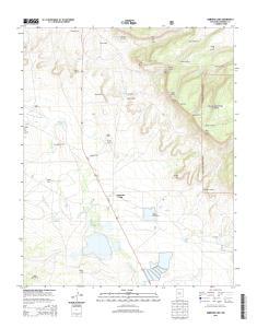
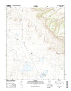
AMBROSIA LAKE, NM 2013

FS High

L Clearance Route

7 6 4 3 0 1 6 3 8 2 5 2 7 NSN. NGA REF NO. U S G S X 2 4 K 8 4 5

39

2

107°52' 30"

Arroyo del Puerto

*7643016382527*

. .. .. ............ . . ..

. .. .. .. ..

6900

7000

9 -5 0 NM

35° 22' 30"

19000mN

7000

6900

o

Mesa Montanosa

rt

7200

¬ «

ue

19

lP

7300

39

Havre Point

39

509